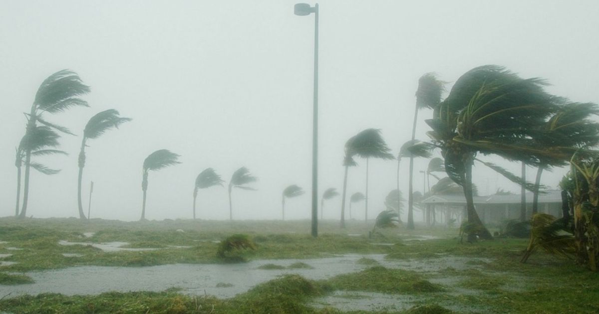
Storms in Florida are a common sight. The beautiful state is surrounded by lush greenery, crystal clear blue beaches, vibrant nightlife, and parks prone to tropical storms due to its warm waters and its location at the intersection of the warm Atlantic Ocean and the Gulf of Mexico (80ºF). These hurricanes have caused severe destruction of the livelihood and well-being of thousands of residents.
Recently, after the paths of Hurricane Humberto and Hurricane Imelda, both of which struck Bermuda before weakening over the North Atlantic, the Atlantic basin has been calm. But not for long. Despite cooler temperatures and the arrival of fall, hurricane season in the Atlantic officially runs through November 30, and forecasters say that residents of Florida should be aware of the volatile weather as it can change at any minute.
According to The Irish Star, the National Hurricane Center (NHC) reported a 50% chance of development in the next 48 hours and a 70% chance over the next seven days. The department added, “The environment is becoming increasingly favorable for gradual development. ”
10-6-25
70% chance of development for this area of thunderstorms in the Atlantic, next name on the list is Jerry. Most modeling keeps this away from US mainland BUT areas in the eastern Caribbean should watch development carefully. pic.twitter.com/q88JRgDv6B— Ginger Zee (@Ginger_Zee) October 6, 2025
Moreover, AccuWeather Senior Meteorologist Dan Pydynowski said that the area of low pressure, labeled Invest 95L (AL95), is located off the coast of Africa near the Cabo Verde Islands. This system is currently producing a large area of disorganized thunderstorms and cloud cover.
According to reports from the NHC, there’s a 50% chance of development in the next 48 hours and a 70% chance over the next seven days. Furthermore, Dan Pydynowski claimed that the storm would bring heavy winds and rain as it curved northward, remaining east of the U.S. mainland. It’s predicted to head towards the west into the Caribbean Sea.
Interestingly, Florida has already been hit by Imelda, Humberto, and Bermuda. Now the upcoming one will be named Tropical Storm Jerry, making it the 10th named storm of the 2025 Atlantic hurricane season. Tropical Storm Imelda and Hurricane Humberto hit the northern Caribbean, the Bahamas, Bermuda, and the U.S. East Coast in late September 2025.
Fort Meyers,Florida…
Never Under-Estimate the Power of Water…
This is What 10+ feet of Hurricane Storm Surge Looks like…
🙏🙏🙏🙏🙏🙏🙏🙏🙏🙏🙏🙏 pic.twitter.com/r3vBvFh4cB— 🇺🇸🇺🇸777DEAN777🇺🇸🇺🇸 (@77HERCULES77) October 2, 2022
A satellite image captured on September 28 by the VIIRS (Visible Infrared Imaging Radiometer Suite) showed how the waves approached. For the unversed, the proximity of these two storms could cause them to interact through a phenomenon called the Fujiwhara Effect.
While Imelda had already caused flooding and rain in Puerto Rico and eastern Cuba, Humberto remained away from the land. However, its giant waves and strong currents alerted the weather forecasters. As of September 29, forecasters noted that Imelda appeared to be shifting towards the east-northeast, away from land. So far, no Atlantic hurricanes have made landfall in 2025 (via Earth Observatory).
Yet, these instances prove that the ocean is a fierce force of nature and that no man can fight against it. It’s best to be prepared with essential precautions for the worst scenarios. Though still days away from a potential landfall, hurricane experts urge residents across the Caribbean and U.S. East Coast to stay alert till the end of next month and meticulously monitor forecasts.